Discover the route of the Arco del Coronadero arch in Gran Canaria
Discover the route of the Arco del Coronadero arch in Gran Canaria
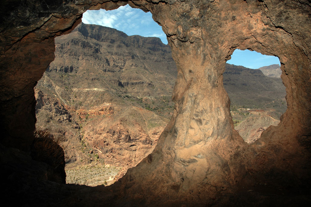
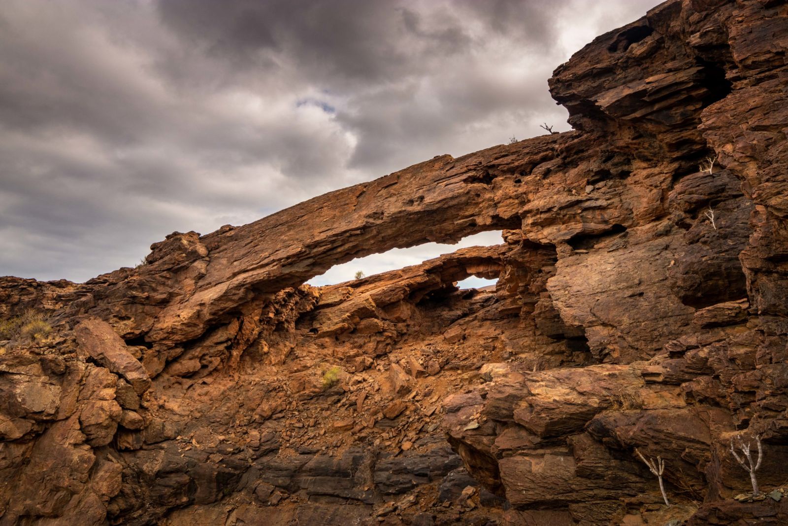
The Arco del Coronadero is a unique rocky structure located on the edge of one of the most impressive ravines of Gran Canaria, the so-called Barranco Hondo. Curiously, and despite its grandeur, not many people know about this area of Amurga.
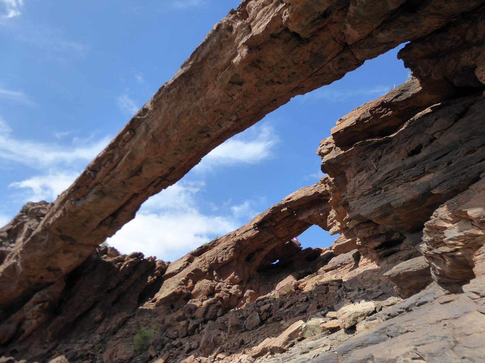
It’s a spectacular double arch that extends almost horizontally over the slope of the ravine. Because of its position, you can’t see it very well from a distance, which means that you have to get quite close to it to see it in all its splendour.
If you’re adventurous and would like to get to know a remote, lost and abandoned place, far from civilization, where the geological spectacles are protected by the grandeur of the volcanic nature that created them, you can’t miss el Arco del Coronadero.
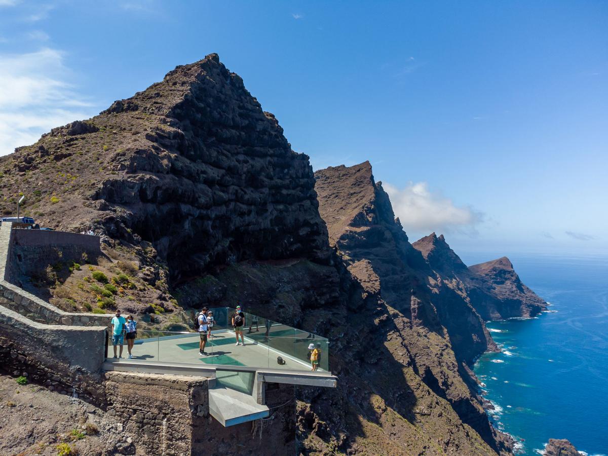
Many people, stunned by the geological spectacle, compare the whole area to the Grand Canyon of the Colorado and the Arches National Park in Utah, both located in the southwest of the USA.
Like that, the hiker, on the backs of slabs of phonolithic lava flows some 12 million years old, discovers what Amurga has to offer, ranging from geological, archaeological, ethnographic and botanical values to botanical ones.
Arco del Coronadero and Barranco Hondo hiking route
Every prize requires an effort and enjoying this incredible natural arch is no exception. To get there you have to follow a short hiking route that can take two paths: along the bed of the ravine or along the upper part of it.
On your way, you’ll enjoy majestic views of the Barranco Hondo channel from the top, while on the return journey you can observe the natural spectacle of the rock canyons that rise up at the top.
On this route it’s totally impossible to discover everything, since you only pass by a small part of the 5,810 hectares of the terrain of Amurga, centred between the Tirajana and Fataga ravines.
To get to the arch you have to walk less than 5 km from the village of Juan Grande, on the land next to an aggregate crusher. You can leave the car in a small dirt area on the side of the road, before passing the fence that gives access to the crusher, to the south of the motorway.
Bear in mind that the barrier is lowered when the industry closes, so you can get stuck with your car if you continue. As the first stretch towards the Arco del Coronadero is along the side of the road, extreme caution should be taken as there’s a lot of lorry traffic.
At first the trail is quite unattractive and boring because it runs through a flat and somewhat desolate landscape. However, the further inland you go, the more interesting the landscape becomes. Once you reach the vicinity of the arch, leave the path to the right to reach its exact location.
The descent to start the return journey begins by returning to the path after passing the arch. From there you have to look for a path that descends almost vertically towards the bottom of the ravine. This descent can be seen once you’re there, but gets lost at times.
The slope down to the bottom of the ravine is dangerous, so you should be very careful. Once you reach the riverbed, you can't get lost on the way back.
When you reach the end of the hiking route, you’ll feel like having won two prizes instead of one: in addition to the discovery of the Arco del Coronadero arch, you’ll discover the Barranco Hondo itself.
If you want to discover the marvellous nature in first person, we recommend you to stay in an accommodation nearby. Don't hesitate to look at all the available options we’ve prepared for you at VillaGranCanaria.