Barranco de Azuaje Ravine Hiking Route
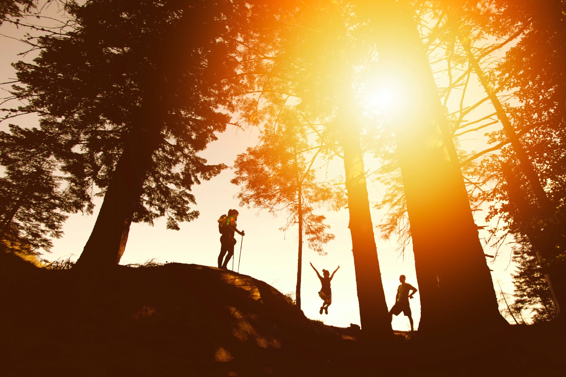
The Barranco de Azuaje ravine is one of the best places for hiking in Gran Canaria. In fact, it is living proof that this island is a true miniature continent, where you can hike through arid landscapes in the south or visit jungle refuges in the north like this one.
Indeed, this paradise is a symbol of a past that was completely covered by the lush Selva de Doramas jungle, a large wooded area of laurel forest that covered the north of Gran Canaria and which can still be seen today here and in a few other places, such as Los Tilos de Moya.
The origin of the name of this majestic ravine comes from the surname of Francisco de Azuaje, a former alderman and sugar industrialist of the Guadalupe ravine. This spectacular ravine starts at the summit at an altitude of 1,600 metres in the upper part of the municipality of Valleseco, exactly in the Degollada de Las Palomas hill.
There it gets the name of Barranco de Crespo ravine, then becomes known as Barranco de La Virgen ravine, then Barranco de Las Madres ravine, then Barranco de Guadalupe ravine and finally takes the name of Barranco de Azuaje ravine until it flows into the sea in the locality of San Andrés, on the coast of Arucas.
Barranco de Azuaje ravine walking route on Gran Canaria
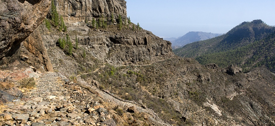
The narrow, boxed-in bed of this ravine is one of the best options for hikers and amateurs of all levels to give free rein to their passion along a simple and complete route that can even be done with children.
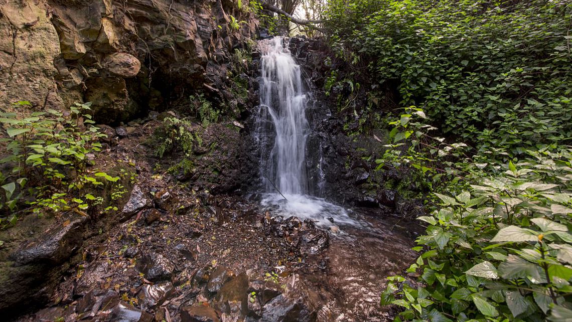
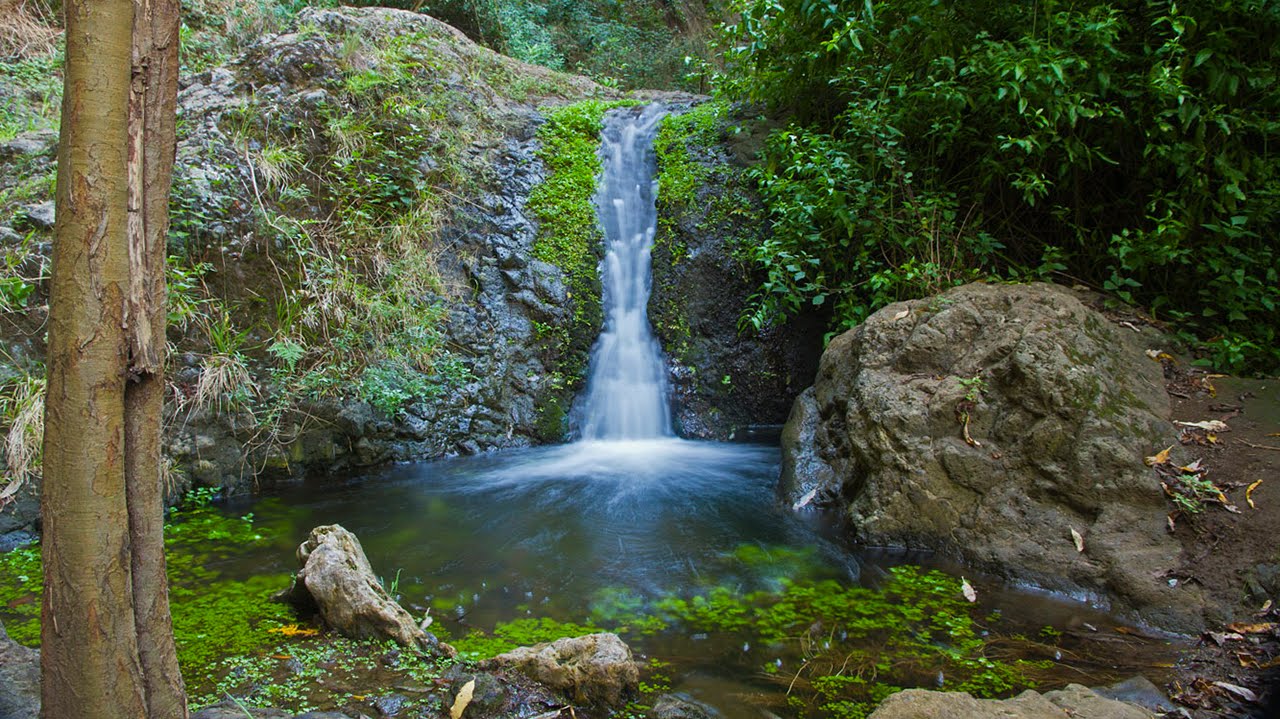
The verticality of the walls of Azuaje make it the deepest ravine in the north, with a V-shaped profile. It also has a permanent flow of water, which is very evident in some sections of its trajectory. This gives it an extraordinary biological richness, making a visit to it more than justified.
As the ravine has a long extension (as we have said, it goes from the summit to the north coast of Gran Canaria), we will focus on a short route suitable for all audiences and, above all, to do with children.
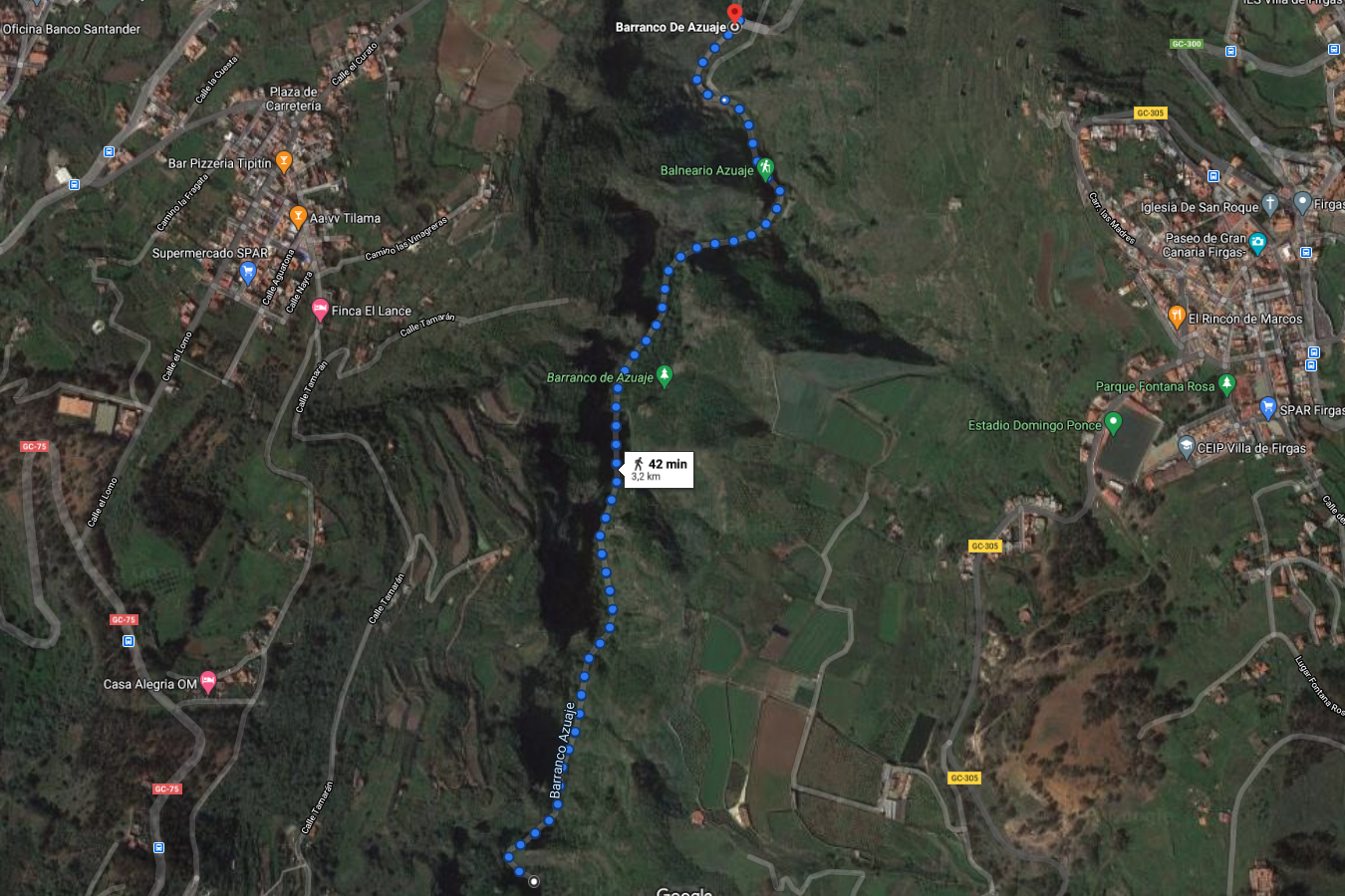
This circular hiking route starts at the intersection of the ravine with the GC-350 road, where the route begins by ascending the ravine. We leave a parking area on our right and, as we continue walking, the Balneario de Azuaje spa, which we will talk about later, will majestically appear on our left.
On this simple route of only about 3.2 km in total, we will be accompanied by stretches of a small stream with a spectacular leafy landscape that will delight all walkers.
The ascent will end when we reach an area of large rocks with ropes that we will have to climb if we want to go even further. However, we will turn around and walk back to the starting point.
Technical data of the route
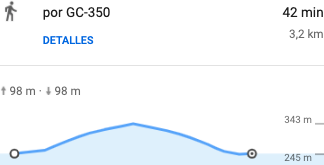
- Difficulty: low
- Distance: 3,2 kilometres
- Duration: 42 minutes
How to get to Barranco de Azuaje ravine

The easiest way to reach the starting point of our route is from the north, where we will have to take the GC-2 motorway and take exit 15 and follow the signs in the direction of Moya.
We will join the GC-75 road until we reach a crossroads where we will have to turn left when we see the sign (Buen Lugar, Firgas, Arucas) and connect with the GC-350 until we reach the ravine and turn right onto a narrow road where we can enter and, after about 100 metres, reach the small car park.
Azuaje Special Nature Reserve

The area of the ravine over the spa forms the Special Nature Reserve of Azuaje, so it enjoys important legislative protection. It is also a Special Area of Conservation (ES7010004 Azuaje) of the Red Natura 2000 network.
Features
This small reserve with a surface area of 61.1 hectares located between the municipalities of Firgas and Moya is concentrated in 5 kilometres of ravine, open to the north and deeply excavated in recent basaltic materials.
It has been slowly filled in by the deposit of alluvial materials derived from its own function. Subsequently, these have been incised, which has given rise to the current bed of the ravine.
This continuous action of erosion and filling in of materials has produced a very particular landscape, with deep ravines and steep slopes, reaching a height of 200 metres at some points.
There are no known large-scale uses in the area, but there are small terraces in the northern part of the reserve, which bear witness to minor agricultural use. There are also numerous water springs in the interior of the ravine, and the abundant remains of fossils that appear in different places on the slopes are also of great interest.
Flora

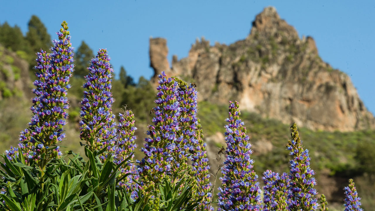
With regard to the vegetation of the Barranco de Azuaje ravine, it has an aquatic habitat, with freshwater species from the small permanent watercourse that runs through it.
There is also important rock flora on the steep slopes, together with examples of laurel forest. Some of these species are endangered, such as the Sambucus palmensis, which has the only known populations in Gran Canaria.
Its escarpments are home to botanical rarities on the verge of extinction, such as the Solanum vespertilio ssp. doramae, the Isoplexis chalcantha, exclusive to some of the relicts of monteverde on Gran Canaria, and two species endemic to the islands of Tenerife and Gran Canaria: the Pleiomeris canariensis and the Dorycnium broussonetti.
It also collects traces of plants imprinted on calcareous tuffs from around 500,000 years ago, in the Middle Pleistocene. The most striking of these are dragon tree leaves (Dracaena draco).
Fauna
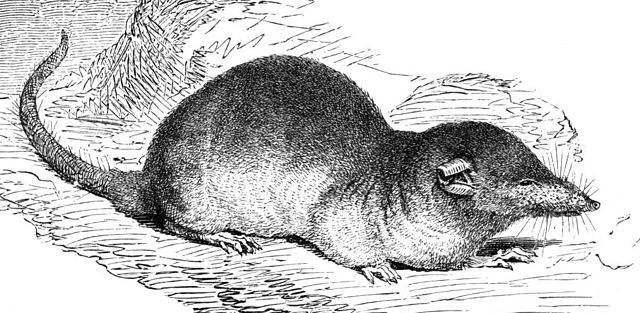
As for the animals, these are mainly represented by a mammal, the Osorio's shrew (Crocidura Osorio), originally from the south of the Iberian Peninsula, which arrived on the island via the ports. There are also nocturnal birds of prey such as the short-eared owl (Asio otus canariensis).
It is also an area of introduction of the rabiche pigeon (Collumba junoniae), an endemic species that became extinct in Gran Canaria at the beginning of the 20th century, as part of the Life + Rabiche project in the Barranco de Azuaje ravine.
Balneario de Azuaje spa
The volcanic nature of Gran Canaria has caused the birth of springs with mineral-medicinal waters with varied contents such as iron, silicates, carbonic gas, hydrosulphuric...
This meant that at the end of the 19th century, when the development of industrial capitalism made medicinal water spas popular among the European wealthy classes, the first tourists came to Gran Canaria to try out the curative properties of the new spas, which were surrounded by an extraordinary natural environment.
Thus, the Hotel-Balneario de Azuaje spa was inaugurated in 1868, generating an offer of accommodation in inns occupied by bathers who came to this privileged place for health. In addition, islanders used to come here, especially to celebrate their honeymoon.
Unfortunately, the spa was closed around 1938 due to health reasons and the negative circumstances of the Spanish Civil War. Even so, dances continued to be held here until the huge flood caused by the storm of October 1955 destroyed the baths and the surroundings deteriorated.
Mirador de Azuaje viewpoint
From the Mirador de Azuaje lookout you can contemplate all the splendour of this ravine of the same name from its beginning at the summit to its mouth at the coast. It is located in Buen Lugar, a small village a few minutes north of Firgas.
If you are looking for privacy and tranquillity on your next holiday, then you need a country house. Imagine waking up every morning surrounded by nature and its sounds, as well as having the opportunity to explore the beautiful landscapes of the island.
Take a look at the available options we have on our website VillaGranCanaria at the best prices on the market. We’re waiting for you!