The Way of Saint James in Gran Canaria
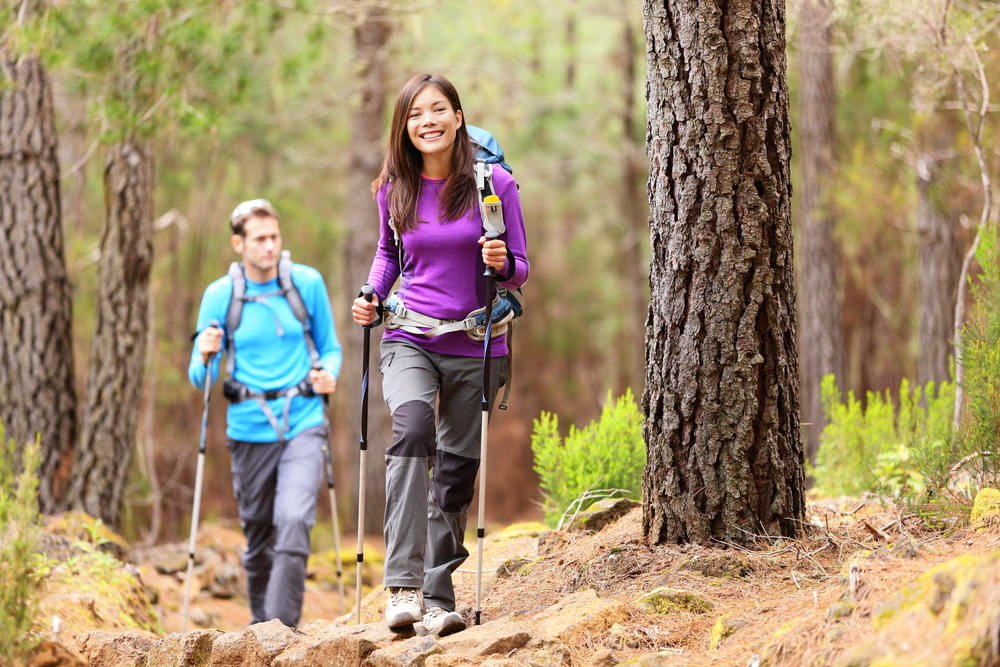
The Way of Saint James in Gran Canaria? Yes, you read that right. Believe it or not, this island has its own official hiking route that you can do alone, with your family, with friends or even with strangers in an unforgettable and enriching experience for body and soul.
Tamarán (as the island was called by the ancient aboriginal settlers) is the only recognised route outside the European continent that takes walkers across Gran Canaria from south to north with an open heart, discovering first-hand why this island is also known as the ‘miniature continent’.
Doing this Jacobean route is something that happens suddenly at a certain moment without ceremony or solemnity. It is probably an idea that has been orbiting in the back of one's mind and finally materialises into a certainty. However, it is logical that certain doubts arise…
What now? Do I have to train? How much should I train? What equipment, clothing and footwear should I take? Where to sleep? Where to eat? Is it better to do it individually or in company? Is it a route suitable for beginners or is it aimed at experts? All these questions, and many more, are answered below.
History of the Way of St. James in Gran Canaria 😇
The privileged geographical location of the Canary Islands in the middle of the navigation routes between Europe, Africa, Asia and the Americas attracted a multitude of sailors, merchants and soldiers from Castile and other nations since its discovery.
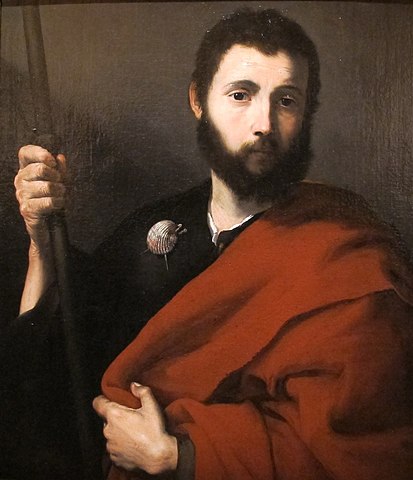
Thus, legend has it that at the end of the Middle Ages (around the 15th century) a ship whose crew of Galician sailors were very devoted to the apostle Saint James the Great was hit by a sudden storm south of Gran Canaria.
Once on dry land, and after their prayers saved their lives, they contemplated the high mountains of Tirajana from Arguineguín and promised to take the figure of the saint to the top of the mountains and build a hermitage for his veneration in the future Santiago de Tunte.
Almost at the same time, but in the north of Gran Canaria, the first mass on the island was celebrated in 1481 near the future Gáldar Main Temple and Archpriestly Church of Knights of Saint James, as the town was named by the Castilians.
Since many people throughout history made pilgrimages from one place to another, in 1965 Pope Paul XVI granted a Papal Bull with the same privileges as the Way of Saint James to Compostela.
A few years later, His Holiness John Paul II granted this Bull in perpetuity. Thus, those who make the pilgrimage to this northern church can receive three types of indulgence at the end of the route, equivalent to those obtained on arrival at Santiago de Compostela:
- That of the ordinary visit during the whole Jubilee year.
- The one corresponding to that of the day of the Holy Lord St. James to be earned on 25 July.
- The extraordinary one that is earned both on the day of the opening of the Holy Door every 1st January of the Jubilee Year and on the day of the closing of the Holy Door on the last day of the Jubilee Year, 31st December.
Jacobean Route of Gran Canaria🥾
The Way of St. James in Gran Canaria is not very well known, even by the inhabitants of the island. Undoubtedly, when talking about the Jacobean itinerary, one usually thinks (and rightly so) of the route that leads to the Galician capital.
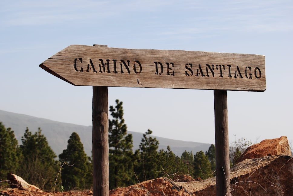
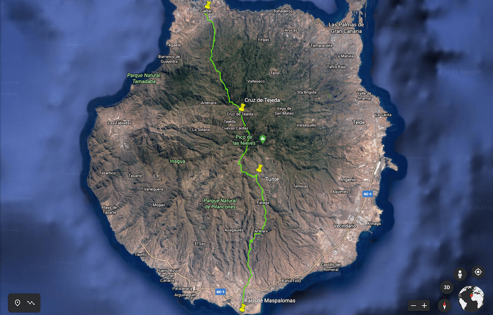
However, even if it is not via the classic French Way, the Northern Way, the Portuguese Way or the Silver Way, it is possible to follow the Way of St. James from Maspalomas to Gáldar along dirt tracks, roads, royal paths and more.
Unlike the traditional Way of St. James, this route through Gran Canaria has no official markings or signs, so it is recommended to use a GPS device that works without an internet connection.
Stage 1: Maspalomas ➡️ Tunte (28 km)
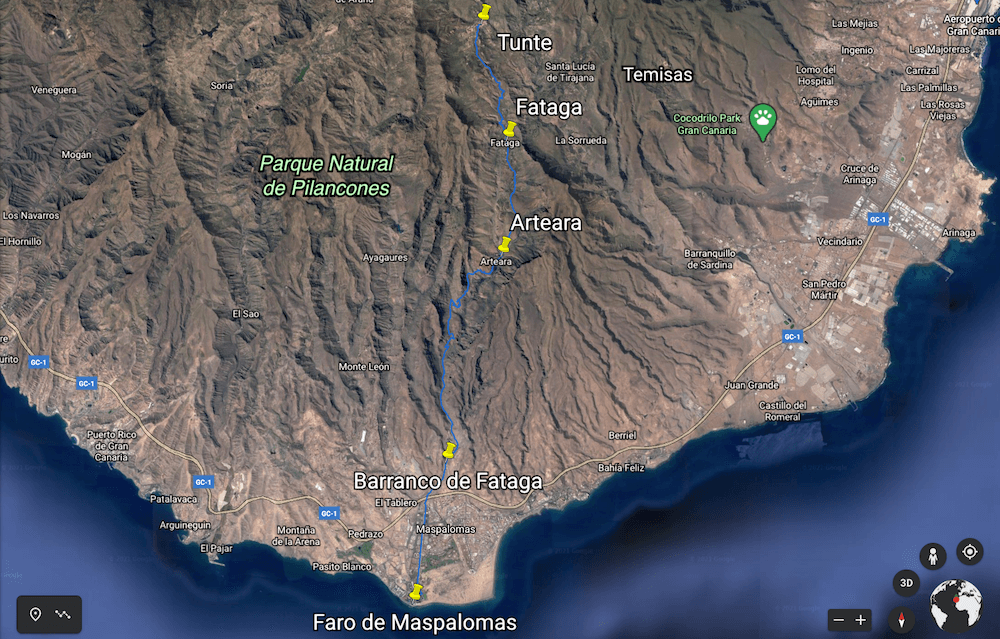
Although this first stage does not correspond to the Jacobean route of Gran Canaria, it is undoubtedly a great excuse to relive the legend of those heroes from the sea who crossed the island from the south to the highest point of the island.
It is a long uphill hiking route that starts in Maspalomas and climbs through the Fataga ravine, passing through the village of Arteara, the town of Fataga and ends in Tunte after 28 kilometres of walking.
The Way of Saint James in Gran Canaria starts at the Maspalomas lighthouse (the southernmost point of Gran Canaria) and heads north. We turn right at the first roundabout and we turn left when we reach the Maspalomas pond.
We will always follow the hiking route up the Maspalomas ravine, passing the Tony Gallardo Park, the Holidayworld Maspalomas entertainment centre and linking up with the Fataga ravine.
The long ascent of 17 kilometres will take us to the village of Arteara, where we will be able to contemplate the Arteara Palm Grove. After another 5 kilometres we reach the village of Fataga.
We continue the route northwards, stopping at the Fataga viewpoint to observe the impressive views of the southern side of Gran Canaria and, after another 6 kilometres, we reach the end of the stage: Tunte.
TECHNICAL DATA
- Distance: 28 km
- Difficulty: high
- Time: 9 hours
- Slope: +1,200 m, -340 m
- Maximum height: 945 metres above sea level
- Surface: asphalt (28%), dirt (61%), path (11%)
Stage 2: Tunte ➡️ Cruz de Tejeda (16 km)
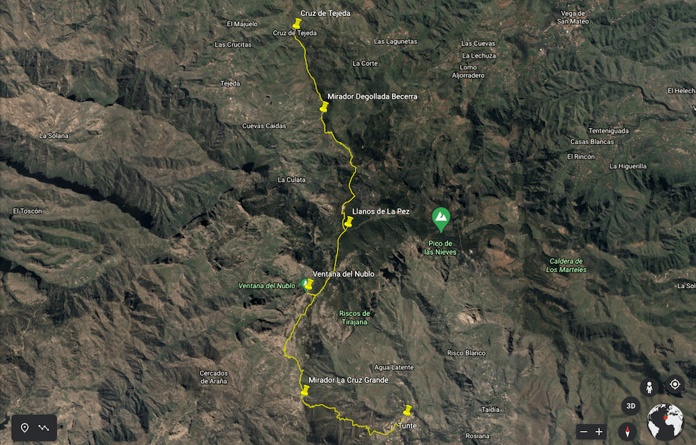
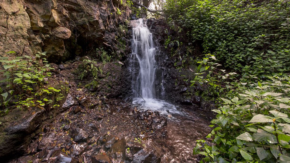
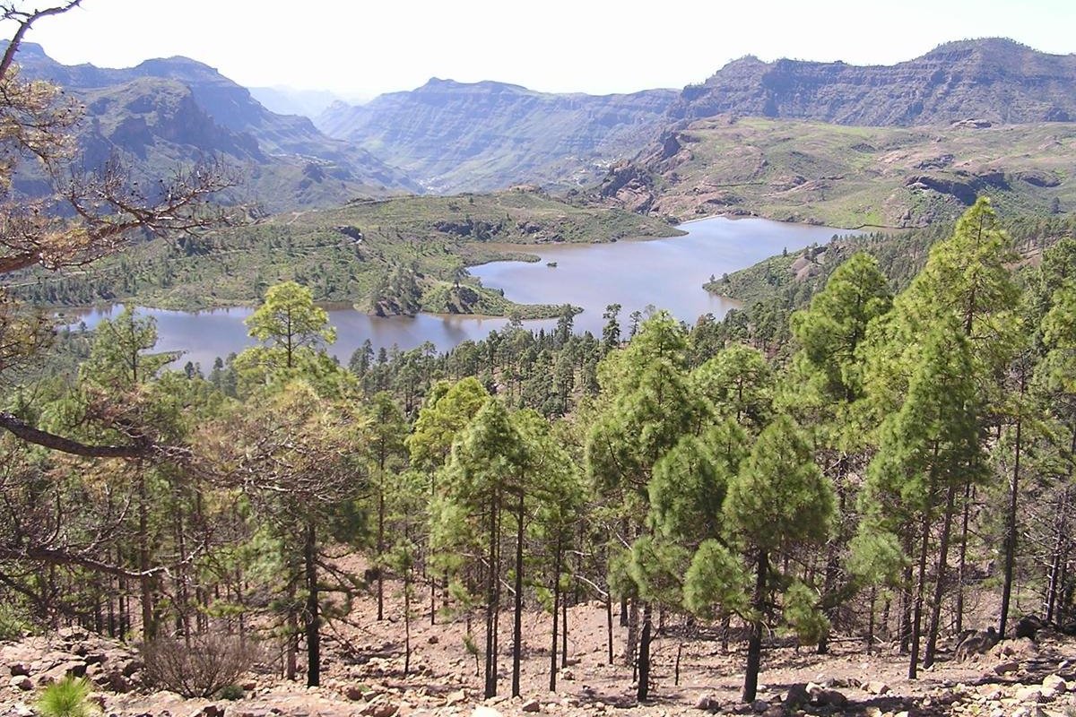
The second stage is really where the Xacobean route of Gran Canaria begins. Although it is the shortest, only 16 kilometres long, it is the most attractive, as we will travel through the heart of the island, discovering an atypical mountain landscape.
We will start from the village of Tunte, from where we will head west through pine forests for about 4 kilometres until we reach the Cruz Grande viewpoint, a place where we can take spectacular photographs of this part of the island.
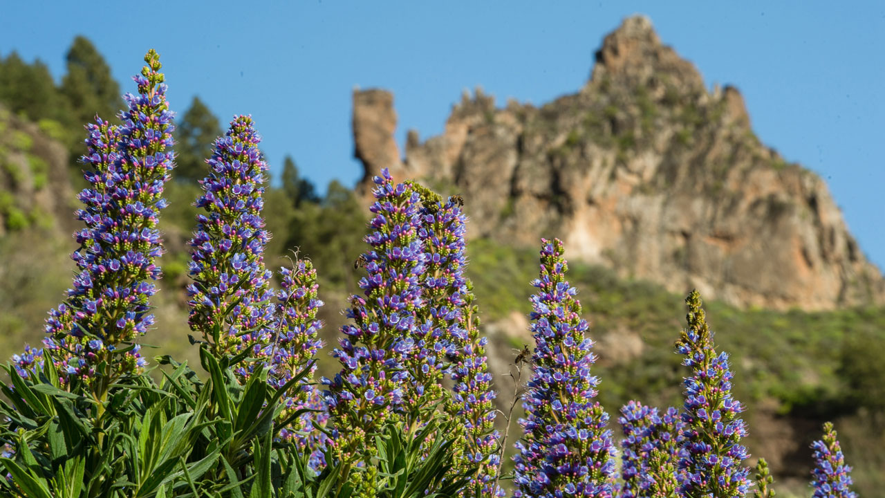
The Way of Saint James in Gran Canaria continues northwards and, after another 4 kilometres, we will arrive at the wonderful Ventana del Nublo window, a famous place to immortalise in a 100% natural setting the giant that watches over the island: Roque Nublo.
We will continue the route towards the north on a beautiful route that will take us past the Llanos de la Pez, the Garañón Camp, the Degollada de Becerra viewpoint and, finally, the Cruz de Tejeda.
TECHNICAL DATA
- Distance: 16 km
- Difficulty: medium-high
- Time: 6:30 hours
- Slope: +1.050 m, -460 m
- Maximum height: 1,720 metres above sea level
- Surface: asphalt (9%), dirt (15%), path (76%)
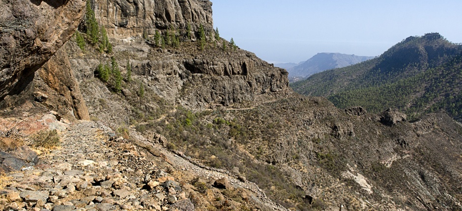
Stage 3: Cruz de Tejeda ➡️ Gáldar (21 km)
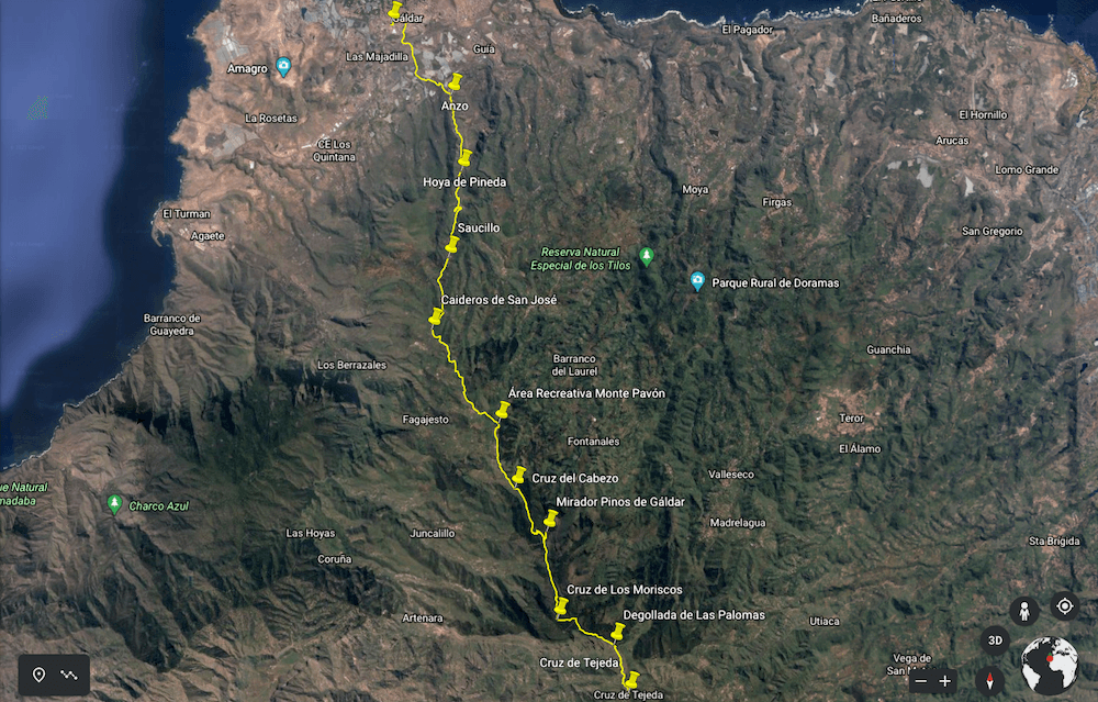
The third and last stage will take us to Gáldar via a 21-kilometre route of practically downhill. We will start at the Cruz de Tejeda and, heading north, we will walk for about 3 kilometres until we reach the Cruz de los Moriscos.
We turn right and after about 2 kilometres we reach the Pinos de Gáldar pine forest, a spectacular area. We continue our descent and, after about 4 kilometres, we will reach the Monte Pavón Recreational Area, an ideal place for a barbecue.
After another 3 kilometres of descent towards the north we will pass near the village of San José de Caideros. We continue our descent and pass through the villages of Saucillo, Hoya de Pineda, Anzo and, after crossing the motorway, we finally reach Gáldar.

TECHNICAL DATA
- Distance: 21 km
- Difficulty: medium
- Time: 8:30 hours
- Slope: +450 m, -1,800 m
- Maximum height: 1,700 metres above sea level
- Surface: asphalt (52%), dirt (5%), path (43%)
The Way of Saint James in Gran Canaria Technical Data 🚶♂️
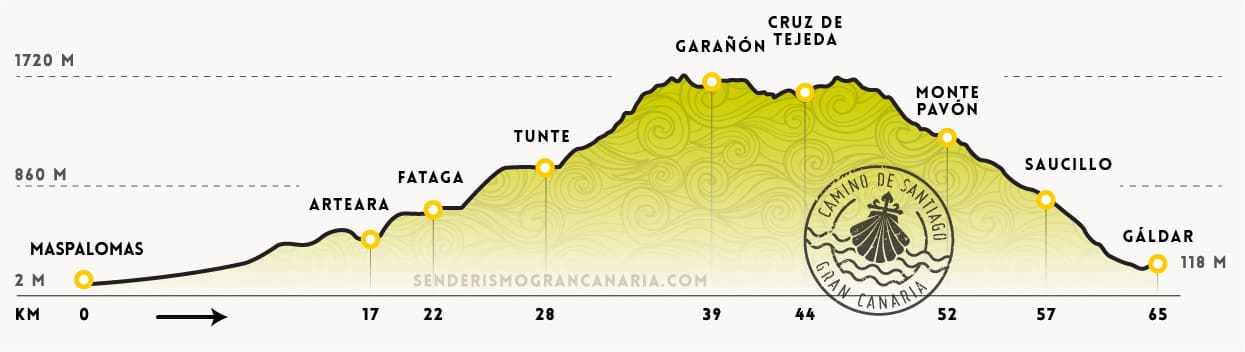
- Distance: 65 km
- Difficulty: medium-high
- Time: 22 hours
- Slope: +2,700 m, -2,600 m
- Maximum height: 1,720 metres above sea level
- Surface: asphalt (31%), dirt (31%), path (38%)
Where to sleep during the Xacobean hiking route in Gran Canaria 🛏️
There is no official accommodation on this pilgrims' route, although there are various establishments where you can stay overnight without any problems. All you have to do is call in advance to check availability. We recommend some of these:
- Stage 1: Rural Suite Santiago de Tunte (Tunte)
- Stage 2: El Refugio Rural Hotel (Cruz de Tejeda)
- Stage 3: Agáldar Emblematic Hotel (Gáldar)
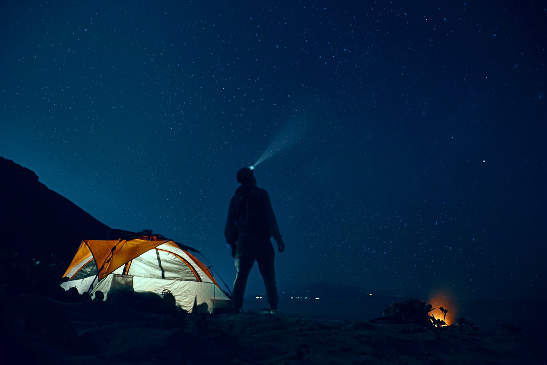
However, if you are one of those adventurous people who prefer to spend the night under the stars, you should bear the following in mind:
- 90% of the route runs through a protected natural area regulated by law.
- It is not permitted to bivouac (sleeping in a sleeping bag) without permission from the Cabildo de Gran Canaria or to camp.
- Overnight stays are allowed on private land with the permission of the landowner.
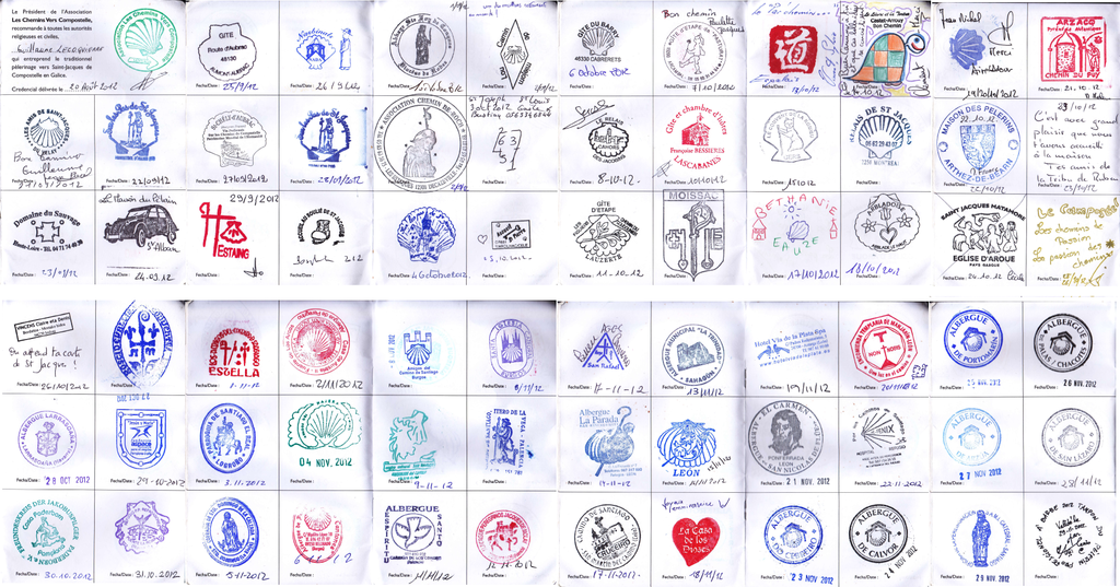
How to get the accreditations: Pilgrim's Credential and Compostela 📜
As with the official Way of St. James, pilgrims on this hiking route in Gran Canaria can also register their journey stamped at the crossing points in order to get the certificate at the destination point.
Pilgrim's Credential 📃
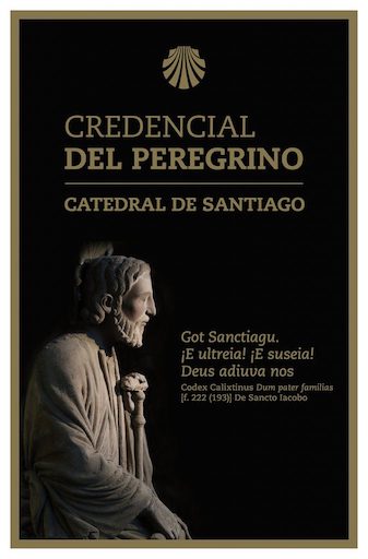
The Pilgrim's Credential is one of the most important distinctions of the Way of Saint James in Gran Canaria. No walker should start the route without it, as it is the document that certifies you as a pilgrim.
It is personal and non-transferable and allows you to obtain the Compostela, so it is irrefutable proof of the pilgrimage. It can currently be obtained in the following places:
- Las Palmas Association of Friends of the Way of Saint James (Calle Salvador Cuyás, 8, 35008, Las Palmas de Gran Canaria)
- Gáldar Tourism Office (Plaza de Santiago, 1, 35460, Gáldar)
Compostela 📄
The Compostela (erroneously called Compostelana) is the Church document that certifies the pilgrimage on the Way of St. James. To obtain it, three basic requirements must be met:
- Doing the Jacobean route for religious or spiritual reasons.
- To have done it on foot.
- Proof that you have walked the route with the Pilgrim's Credential with the corresponding stamps.
- It can be obtained at the Gáldar Tourism Office.
How to organise the Xacobean pilgrimage in Gran Canaria ⛪
Before embarking on the adventure of the St. James pilgrims' route in Gran Canaria, you should know that it is a short but demanding route that crosses different microclimates. So, you have to plan well the Way of Saint James in Gran Canaria according to your experience and physical conditions.
When to Do It ☀️
Although it can be done all year round, it is advisable to avoid summer due to the high temperatures in the midlands of Gran Canaria. We recommend the months after winter, when the landscape is greener and the weather is more pleasant.
Number of Stages ⛰️
The route can be divided into more stages than those previously proposed in order to enjoy the island at a leisurely pace. On the other hand, the more experienced can do it in two or even one day.
Public Transport 🚌
Global is the public transport company of Gran Canaria by guagua (bus). It should be taken into account that the frequency of the lines is low in the smaller villages. The most important ones for the Jacobean route are the following:
- Line 30: Las Palmas de Gran Canaria-Faro de Maspalomas
- Line 18: Faro de Maspalomas-Tejeda
- Line 105: Gáldar-Las Palmas de Gran Canaria
Where to eat during the St. James Pilgrims' Route in Gran Canaria 🍴
There are many places to eat along the way, but depending on the stage, there may not be many or they may not even be open. It is therefore advisable to take some food and drink with you to finish each stage.
It is important to have a good breakfast before starting each day, including carbohydrates, proteins and fruit. There are places along the way where you can replenish your food and water if necessary. In any case, if you follow the marked points you won't have any problems.
What is the Jacobean Holy Year✝️
Pilgrims in penance can ask for total indulgence for their sins if the feast of the apostle St. James the Great, 25 July, falls on a Sunday. When this happens, it is called a Jacobean Holy Year or Compostelan Holy Jubilee Year.